Ice Field Forecasting Framework
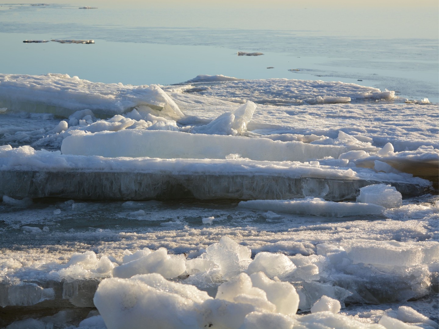
A coupled modelling framework that links what happens at a single turbine to how ice drifts across an entire sea basin – usable both for long-term planning and for day-to-day operations.
Predicting how sea ice behaves around offshore wind farms
As offshore wind farms move into the seasonally frozen waters of the Baltic Sea, they begin to interact with the drifting ice around them. Turbine foundations break, slow and deflect the moving ice, which can locally pile up into ridges and change where ice accumulates.
MARTE has developed a modelling approach that captures these interactions and turns them into practical forecasts. It can simulate how large future installations may reshape ice conditions and predict short-term ice drift to support safe navigation and offshore maintenance.
A multi-scale model, from one turbine to the whole basin
The core of the approach is a multi-scale framework that couples two very different levels of detail.
At the local scale, the interaction between a single turbine foundation and a drifting ice sheet is resolved with high-resolution finite-element simulations (roughly 0.2 m detail) that explicitly capture ice breaking, channel formation and channel closure.
At the basin scale, the NEMO–SI3 hydrodynamic–ice model simulates ice drift and deformation across the full Gulf of Riga at about 1 km resolution.
The characteristic forces from the local simulations are fed into the basin model as an effective resistance to ice motion, so the two scales stay physically consistent.
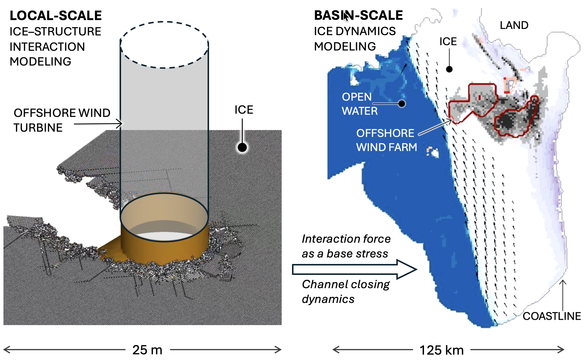
The multi-scale framework couples detailed local ice–structure interaction at a single turbine (~25 m) with basin-scale ice dynamics across the Gulf of Riga (~125 km).
At the turbine, the model reproduces how a channel opens behind the structure as the ice drifts past it. When the wind changes and the direction of ice drift reverses, the channel can close again, driving the rafting and ridging of ice and creating a deformed ice field.
A complementary Lagrangian tracking module follows the deformed ice generated at the wind farm, mapping its drift pathways, probability of occurrence and locations where the ice may accumulate or strand along coasts and fairways.
At the basin scale, the model delivers both integral measures – including ice extent, thickness, volume and drift speed – and spatial maps showing where ice conditions change. Comparing simulations with and without offshore wind farms makes it possible to identify how the installations influence ice concentration, thickness and drift speed across the wider sea area.
From long-term planning to short-term forecasts
Because it connects a single structure to the whole basin, the framework works as a planning tool.
It can assess how different wind-farm layouts may influence ice conditions, showing how changes remain local or extend into the wider sea area. This allows planners and developers to compare different scenarios before installations are built.
The framework also supports short-term operational forecasting. During a recent ice-rich winter, MARTE produced daily 7-day sea-ice forecasts that were shared with national maritime and environmental authorities and operational users.
The forecasts provided information on ice concentration, thickness, drift speed and areas of deformed ice, helping users anticipate changing ice conditions and potential risks.
What the modelling can show
The modelling framework combines several types of output, from detailed ice–structure interaction to basin-scale changes and operational forecasts.
How ice deforms around a turbine
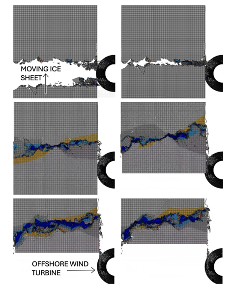
Local simulation: as ice drift reverses, the channel behind a turbine closes and deformed, ridged ice develops.
Where deformed ice may accumulate
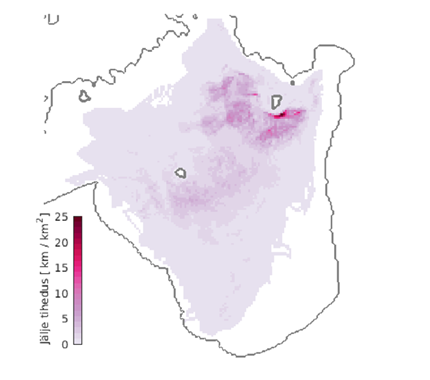
Mean density of wind-farm-induced ridged ice, highlighting areas where deformed ice is most likely to concentrate.
How wind farms change basin-scale ice conditions
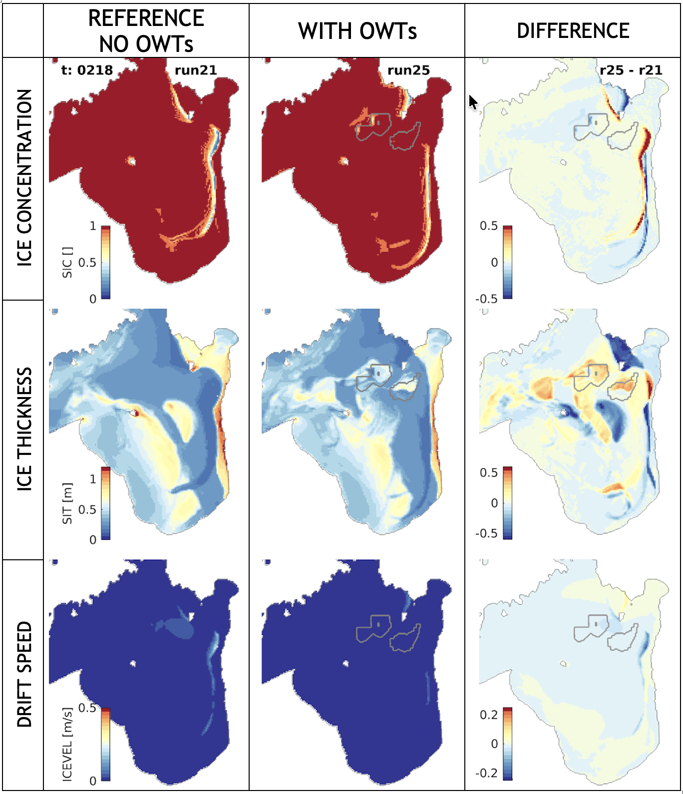
Comparison of ice concentration, thickness and drift speed in simulations without and with offshore wind farms. The difference maps show where the wind farm changes the surrounding ice conditions.
Operational sea-ice forecasting
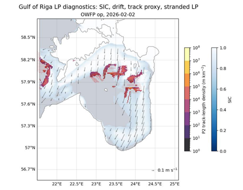
Operational forecast product showing the predicted distribution and movement of deformed ice in the Gulf of Riga.



Funded by the European Union under Grant Agreement ID 101186498. Views and opinions expressed are however those of the author(s) only and do not necessarily reflect those of the European Union. Neither the European Union nor the granting authority can be held responsible for them.